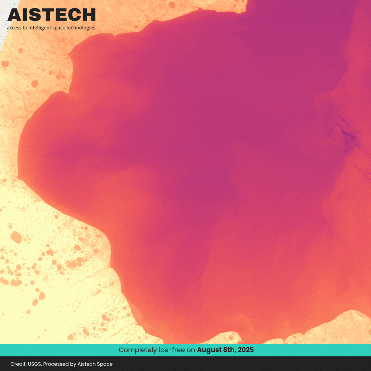
Ice-covered Bay
Sea ice may look stable, but it’s constantly shifting. As Arctic routes open, safe passages can turn hazardous within hours.
High-revisit thermal imagery provides near-real-time visibility of ice dynamics, enabling safer navigation and deeper environmental insight.
- Monitor sea ice movement and rapidly changing conditions
- Enable safer, more efficient Arctic routing
- Track ice edge dynamics and seasonal freeze–thaw cycles
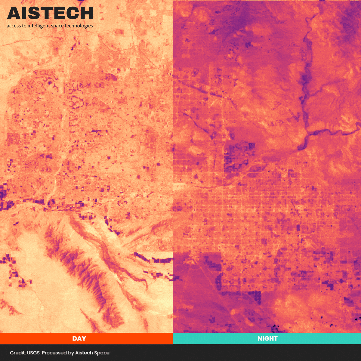
Urban Heat Mapping
Urban areas don’t cool evenly at night. Even hours after sunset, heat remains trapped in certain parts of the city due to materials and urban structure.
High-resolution thermal data reveals these hidden patterns, enabling smarter urban planning and heat mitigation strategies.
- Identify persistent urban heat hotspots and “hot corridors”
- Detect cooling effects of green spaces and urban design
- Support more resilient, equitable city planning
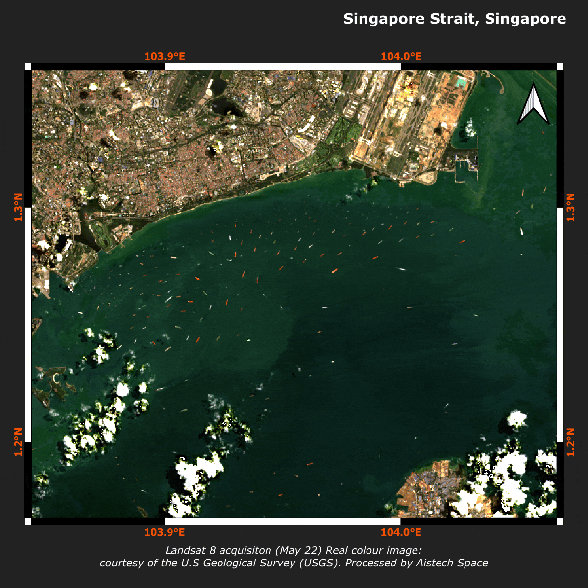
Vessel Detection
Aistech leverages high-resolution Thermal Infrared (TIR) satellite imagery to enable reliable vessel detection without reliance on identification signals, both day and night. By overcoming the limitations of AIS and conventional radar, our solution delivers continuous, high-frequency maritime situational awareness.
The result is faster response, improved detection of illicit activity, and improved protection of maritime security and economic interests.
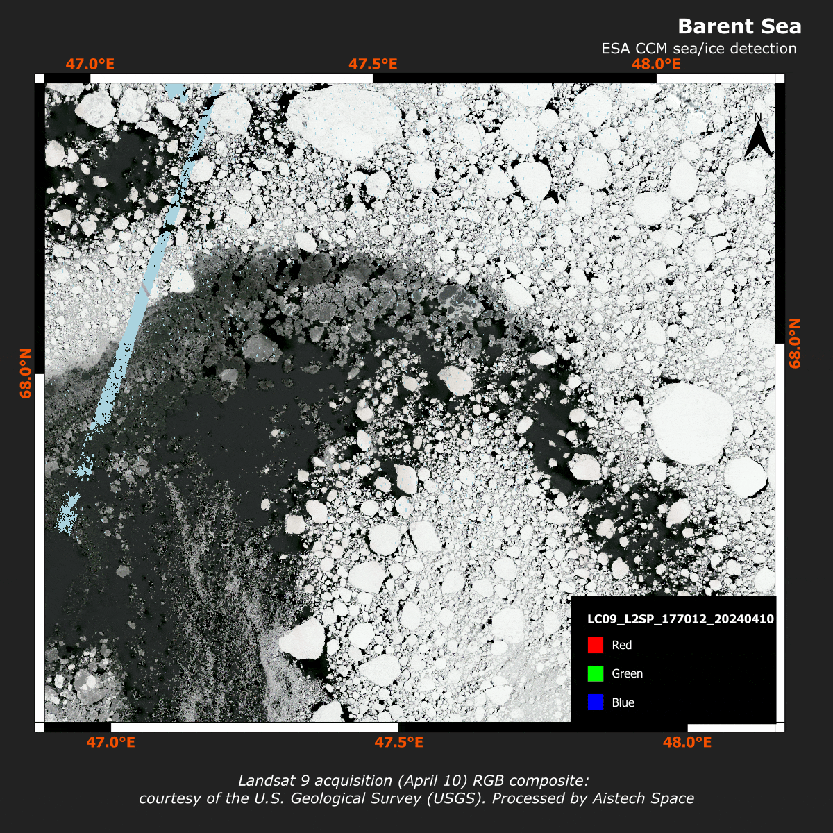
Sea / Ice Border Monitoring
Aistech provides a high-precision sea–ice border monitoring solution powered by high-resolution Thermal Infrared (TIR) satellite imagery and high revisit rates. By combining thermal data with advanced machine learning, our technology delivers reliable, up-to-date detection of sea and ice boundaries in even the most challenging environments.
The result is actionable situational awareness that enhances maritime safety, reduces operational risk, and supports navigation in rapidly changing polar regions.
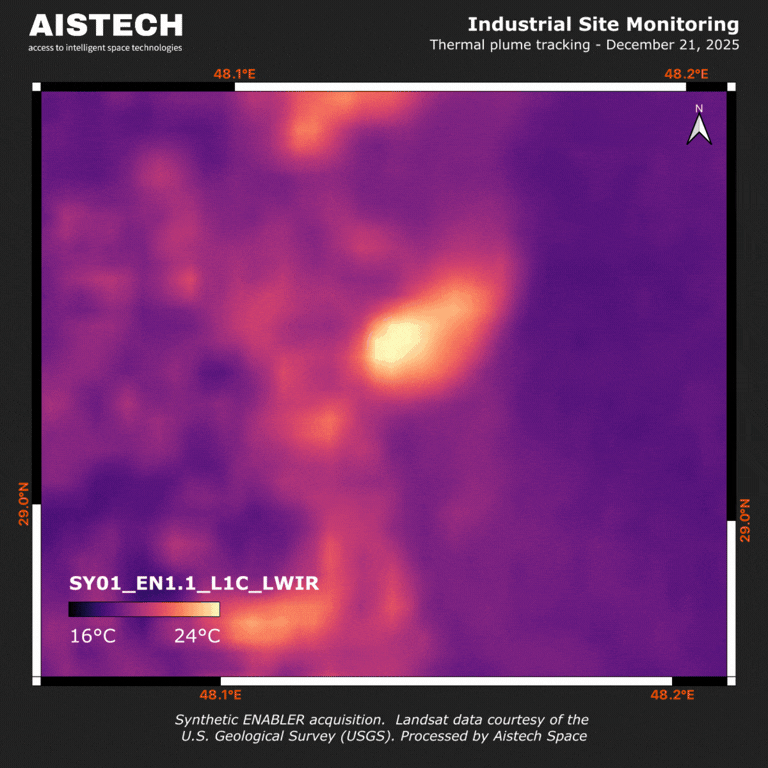
Thermal Plume
Industrial facilities can discharge warmer cooling water into the sea, creating thermal plumes that impact coastal ecosystems.
Using thermal satellite imagery, we detect and monitor the extent and evolution of these plumes over time, providing objective and independent insights to:
- Protect marine biodiversity
- Improve oversight of outfalls and coastal water quality
- Support environmental transparency and accountability
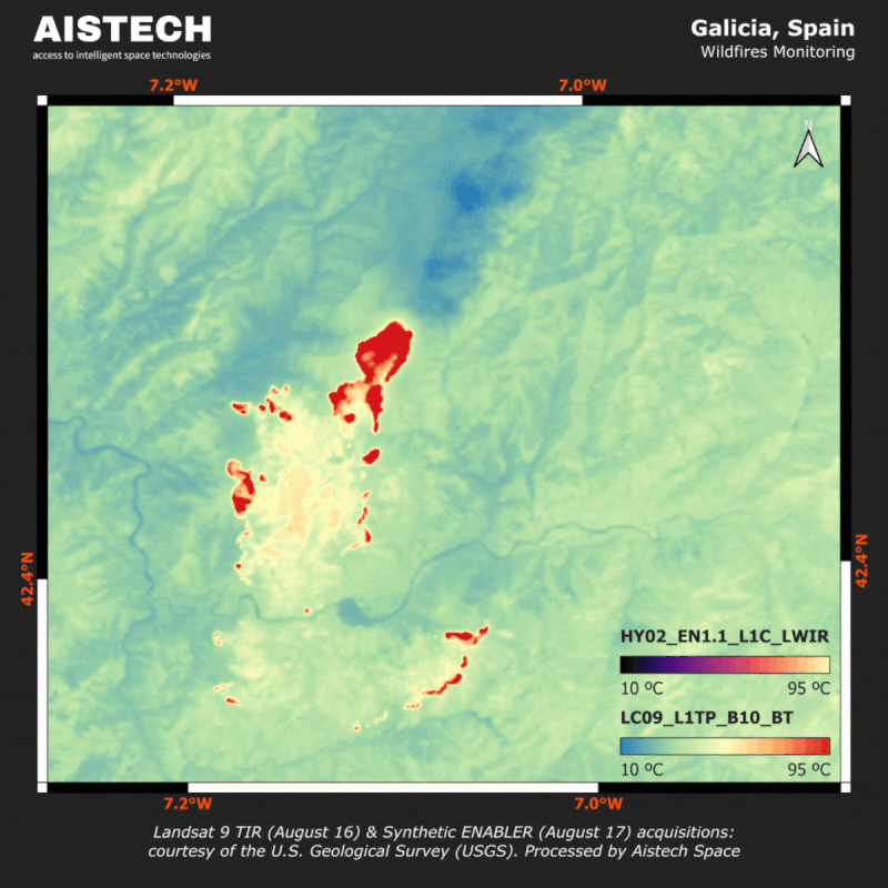
Wildfire
Wildfires evolve in hours, but traditional thermal satellites leave gaps
between revisits.
High-frequency thermal imagery reveals active fire fronts and hotspots as they
change, enabling continuous tracking of fire spread and intensity.
- Detection of active fire lines and emerging hotspots
- Monitoring of fire dynamics over time
- Reduced temporal gaps with sub-daily coverage
- Near real-time situational awareness
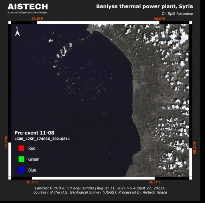
Oil Spill
Oil slicks can be invisible in optical imagery, but detectable in thermal.
Using high-resolution thermal satellite data can help identify, delineate, and track oil spills by capturing subtle surface temperature and emissivity differences.
- Detect spills early
- Map their spatial extent
- Monitor drift and evolution over time