Aistech Space launches the Hydra 2 satellite, marking the beginning of its commercial constellation to provide high-resolution thermal imagery
- Hydra 2 is the first commercial satellite to incorporate the Multispectral Thermal Telescope fully developed by the company.
- With six launches scheduled for 2026 and deployment planned for the 2027–2030 period, the company projects revenues exceeding €150 million by 2030.
Aistech Space, a Spanish space technology company dedicated to the detection, tracking, and monitoring of temperature changes on the Earth’s surface, has announced today the successful launch of its new satellite, Hydra 2, which was launched from Vandenberg Space Force Base in California through launch integrator Exolaunch as part of SpaceX’s Twilight rideshare mission. Hydra 2 marks the official start of the deployment of its commercial constellation designed to provide accurate and recurrent situational information based on high-resolution thermal imagery of the Earth’s surface.
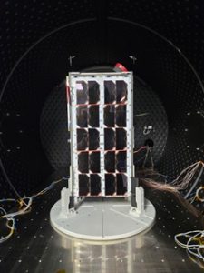
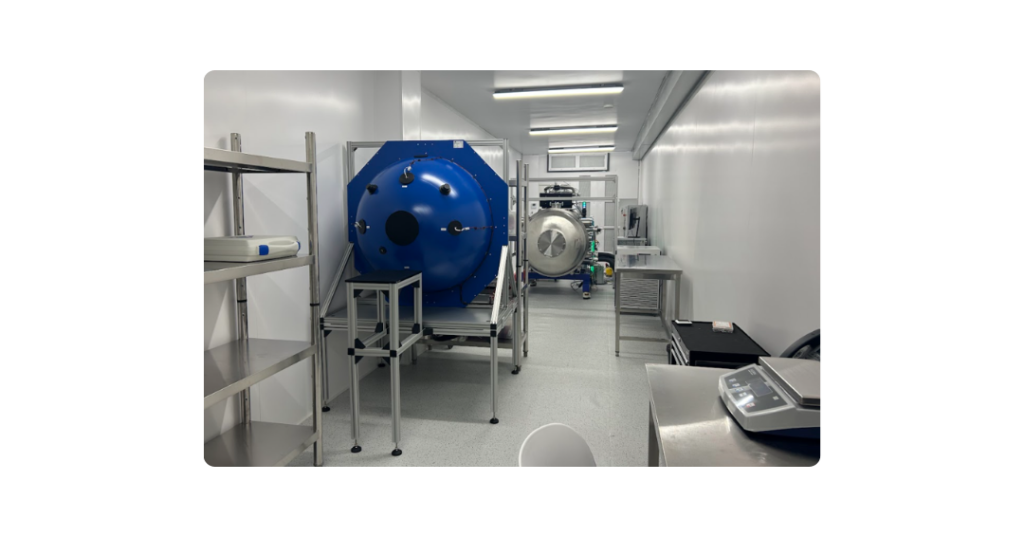
The Hydra 2 satellite, whose development and launch required an investment of approximately one million euros, represents a significant technical evolution compared to its predecessors. This system offers higher resolution and greater precision in data capture, enabling the monitoring of temperature variations in critical areas with unprecedented analytical capabilities. Additionally, this is the first commercial satellite launch to incorporate a state-of-the-art Multispectral Thermal Telescope fully developed by Aistech Space, which received support and backing from CDTI from its early stages.
Monitoring of strategic and environmental assets
Following separation from the launcher, Hydra 2 has entered the LEOP (Launch and Early Orbit Phase), which lasts until the satellite is stabilized, in communication, and in a safe orbit. This is followed by the commissioning phase, during which all subsystems and payload are progressively activated, functionally verified, and calibrated. Commissioning concludes once the system is declared operational and the satellite begins delivering high-value thermal imagery.
Specifically, Hydra 2’s capabilities will enable the development of key applications providing geospatial intelligence-based information, such as early detection and monitoring of forest fires; tracking activity levels in critical infrastructure and production facilities; and monitoring movements in areas of strategic interest and critical zones.
“With this new milestone, we are not only placing cutting-edge technology into orbit and operation, but also opening a new window of knowledge about our planet,” said Carles Franquesa, co-founder and CEO of Aistech Space. “This satellite is proof of our ability to transform space into a precision tool that helps solve critical challenges on Earth. By leading the market with our Earth thermal observation technology, we are providing industries and governments with a service to make data-driven decisions that were previously unavailable, ensuring a more efficient and resilient future for all.”
A cornerstone for Aistech Space’s growth
This launch not only strengthens the company’s technical capabilities but also reinforces its financial position, as it is currently completing a Series B funding round of over €45 million.
Furthermore, the six launches scheduled for 2026, together with the planned deployment of 48 satellites between 2027 and 2030, form the core of the company’s strategic plan, which aims to achieve revenues exceeding €150 million by 2030.
About Aistech Space
Aistech Space, founded in 2015, is a leading space technology company focused on the development, manufacturing, and operation of Earth observation systems to improve sustainability, safety, and quality of life on the planet. Through its technology, the company contributes to protecting valuable resources by detecting and monitoring thermal changes on the Earth’s surface, generating and delivering high-resolution, high-frequency thermal imagery on demand. Aistech Space’s work is key to policies and actions aimed at decarbonization, climate change mitigation strategies, water management for food security, deforestation control through fire risk assessment, and the monitoring and surveillance of both critical assets and sensitive areas of strategic and geopolitical interest.